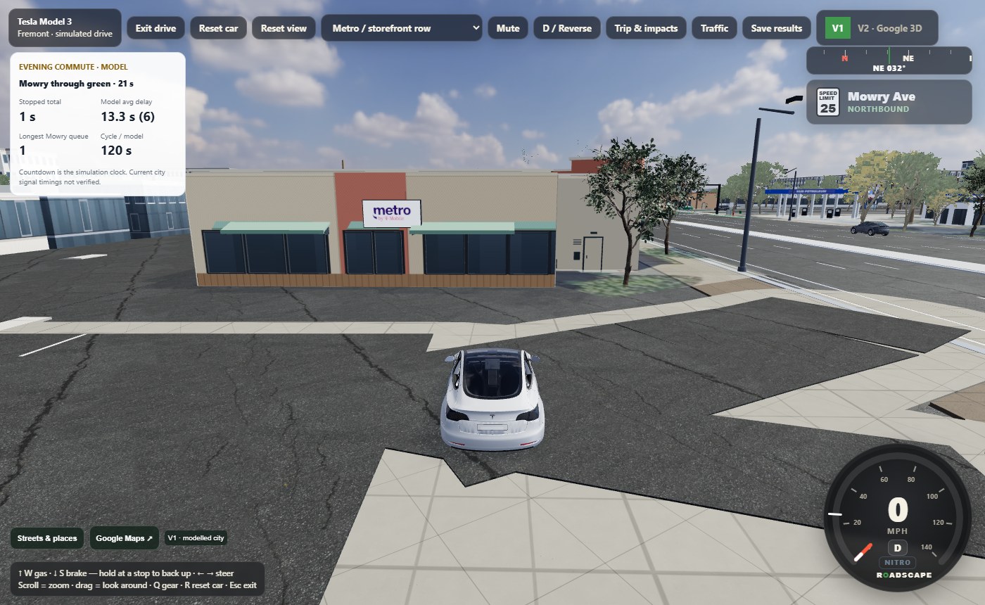
V1 · Modelled Fremont
Detailed storefronts, 3D cars and connected streets.
Roadscape is live and working now - a street-intelligence platform for cities, contractors, engineers, and residents who need road decisions backed by evidence, not just a video tool. It covers the full picture of a corridor: traffic counts, crash context, lane geometry, truck load, pedestrian exposure, and performance forecasting before a change is built, then evidence after.
Roadscape is built to become the planning and evidence layer between proposed street designs, real traffic conditions, public datasets, and post-build performance.
Before concrete, striping, medians, turn pockets, or bike-lane changes are approved, Roadscape organizes likely traffic, safety, emergency-access, freight, maintenance, and pedestrian impacts.
Compare current geometry against proposed schematics: lane width, turn radius, queue delay, new housing demand, truck mix, commute windows, cost, and expected performance change.
Roadscape should not only count what happened. The end point is showing the design outlook, explaining why, and suggesting a better layout or next study step with data, assumptions, and reviewer notes attached.
Four working tools are public, all on the same 3D engine: Video Analyzer, Swept Path Pro 3D, the 3D Swept-Path Simulator, and Facility Route Risk 3D. Pro packets add PDF, custom sites and the engineer review lane.
Open the browser video analyzer, load footage, place count lines, run a fast scan, queue clips, save results, and export evidence packets.
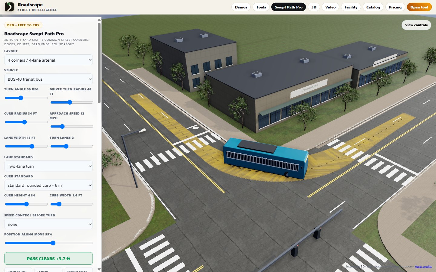
The eight most common street corners plus docks, courts, dead ends and a roundabout on one engine with real trucks, buses and cars. Fleet lineup, road-user checks, speed samples, plan overlay, packet JSON, and a driver take-over mode with real steering and rollover physics: take the wheel, use keys or the phone pad, and see if you go wide.
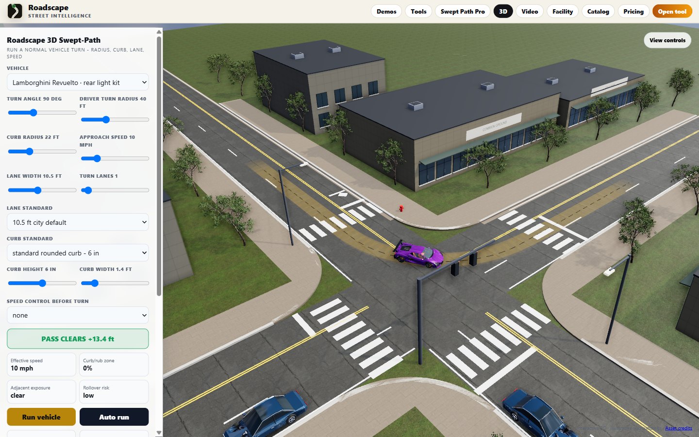
Open the same turn in 3D, orbit the scene, switch to driver/curb/behind views, and show red overrun where the body or tire leaves the usable road. The frame cycles actual in-app views: Lamborghini Revuelto, Ferrari 458, WB-67 big rig and passenger car, straight from the live tool.
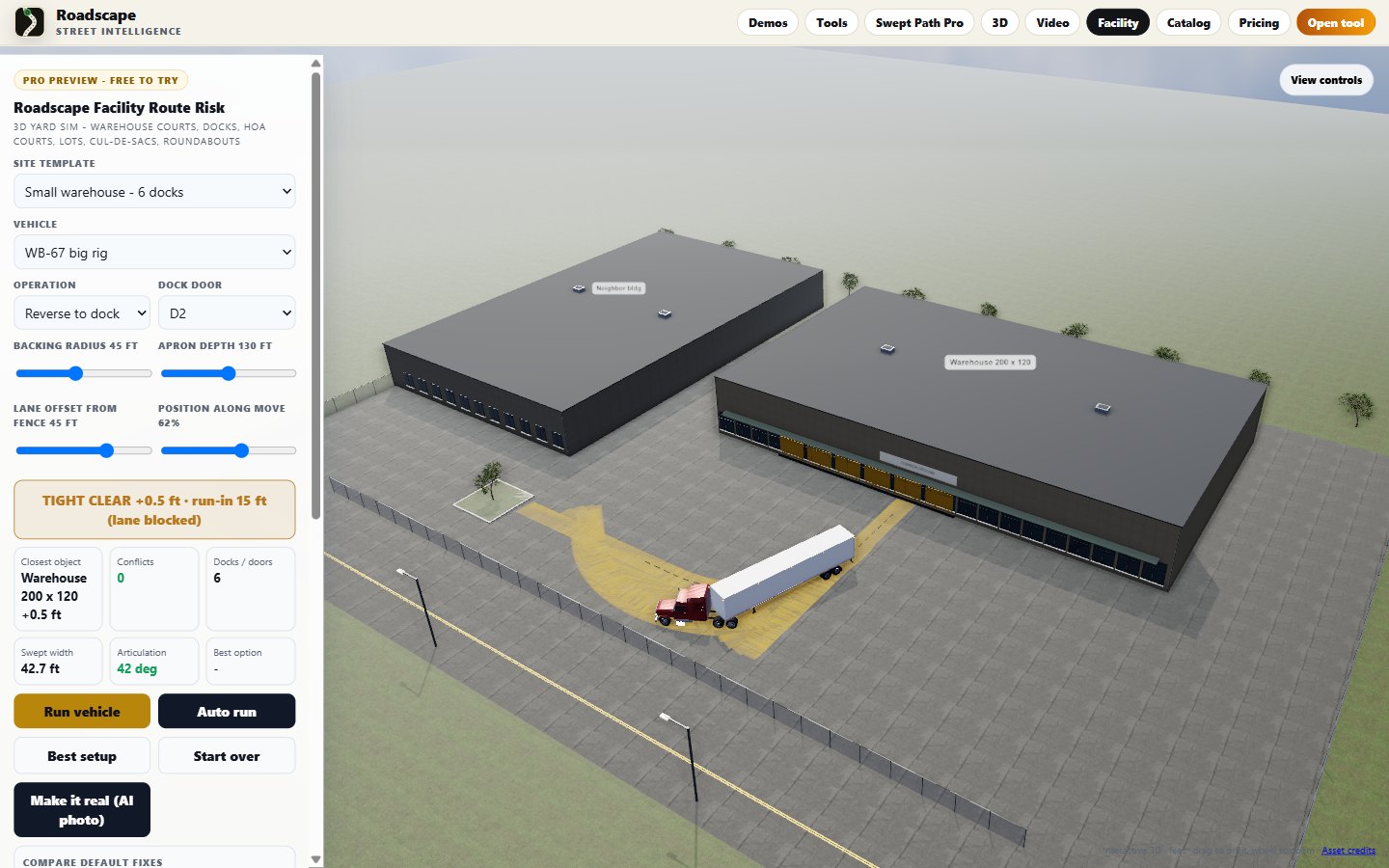
Same 3D engine and views as the simulator, on a yard: warehouse courts, cross-docks, HOA garage courts, alley docks, parking bays, cul-de-sacs and roundabouts. Pick the real vehicle and the move (reverse to dock, 3-point into a garage, K-turn, U-turn, circulate), drag the buildings in Top view, watch the red conflict zones from the drone, dock or driver seat.
Explore Mowry, Fremont Hub, Eggers and the neighborhood. Pick a car and start driving.
Detailed storefronts, 3D cars and connected streets.
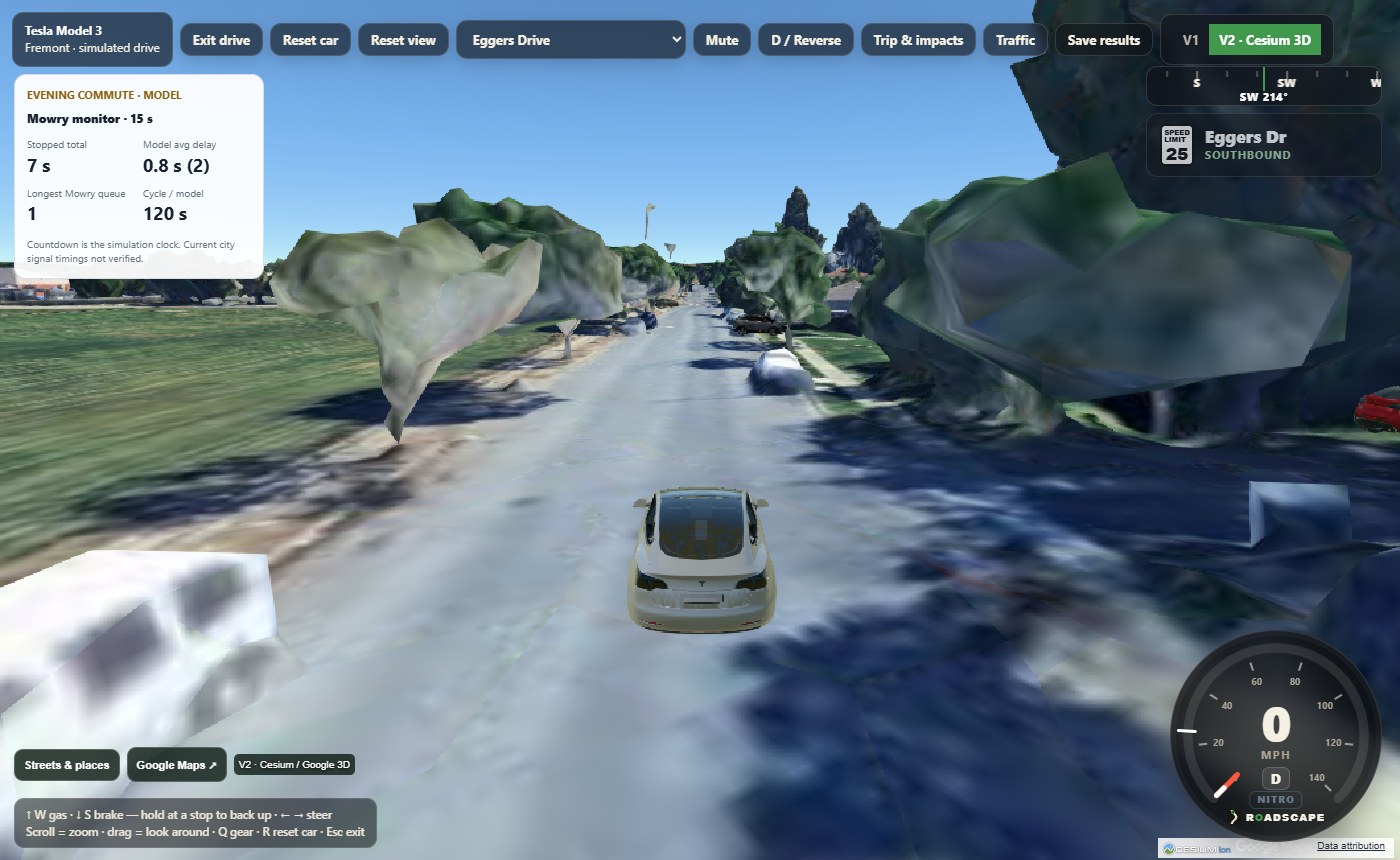
Drive through Google 3D surroundings using the same Cesium renderer as AntlerFlok V2.
Screenshots from the game. Traffic and parking are simulated. Some building details are approximate; Boston Market is a historical location.
What turns raw corridor video into a review-ready packet a consultant, developer, or fleet can act on - fast. Analysis-grade, not PE-stamped; the licensed engineer signs off in the review lane.
Drop in the traffic-count JSON; Roadscape flags which treatments the data screens for - with the reasons and FHWA / CMF evidence references attached. Phrased as "matches Roadscape analysis criteria using FHWA/CMF references" - never a stacked or stamped crash-reduction claim.
Queue 10+ clips (upload or link), run them in the background, review the exceptions. Turns a week of corridor footage into a count table + evidence stills without hand-counting every car - per-clip confidence and a manual-correction lane.
A public, computed accuracy page: clip ID, human hand-count vs. Roadscape count, median error, by class where available. Real bands, not marketing - the number is computed, and that is what earns "analysis-grade" trust.
Every packet ends with a clean PE sign-off block - license #, firm, CA-MUTCD / Caltrans HDM compliance notes, signature + stamp. Roadscape never stamps; it hands the engineer a report already formatted for theirs.
Public pricing is split cleanly: low-cost self-serve tools for people who run checks themselves, plus custom services for packets, white-label work, fleet audits, and enterprise programs. For services, email first; Roadscape sends the signup and Stripe payment link after scope is confirmed.
For residents, students, and basic review.
For prosumers, small consultants, and fleets running their own checks.
For city, fleet, and team workflows that need users, onboarding, support, and custom libraries.
Done-for-you packets and white-label consultant support stay separate from SaaS pricing. Email Roadscape services first; signup and Stripe payment links are sent after scope is confirmed.
Analysis-grade and operational evidence only. Official engineering conclusions still require qualified professional review.
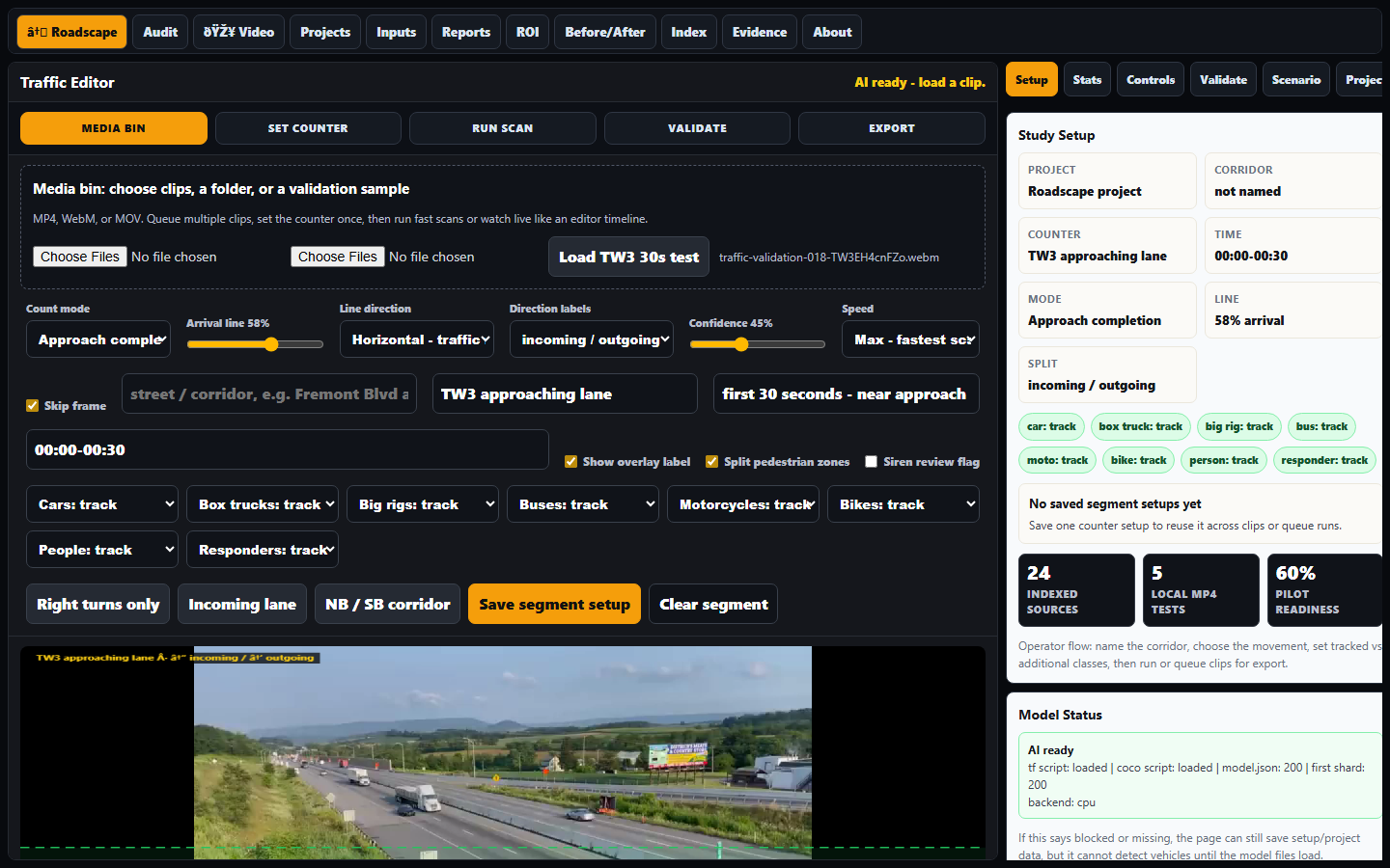
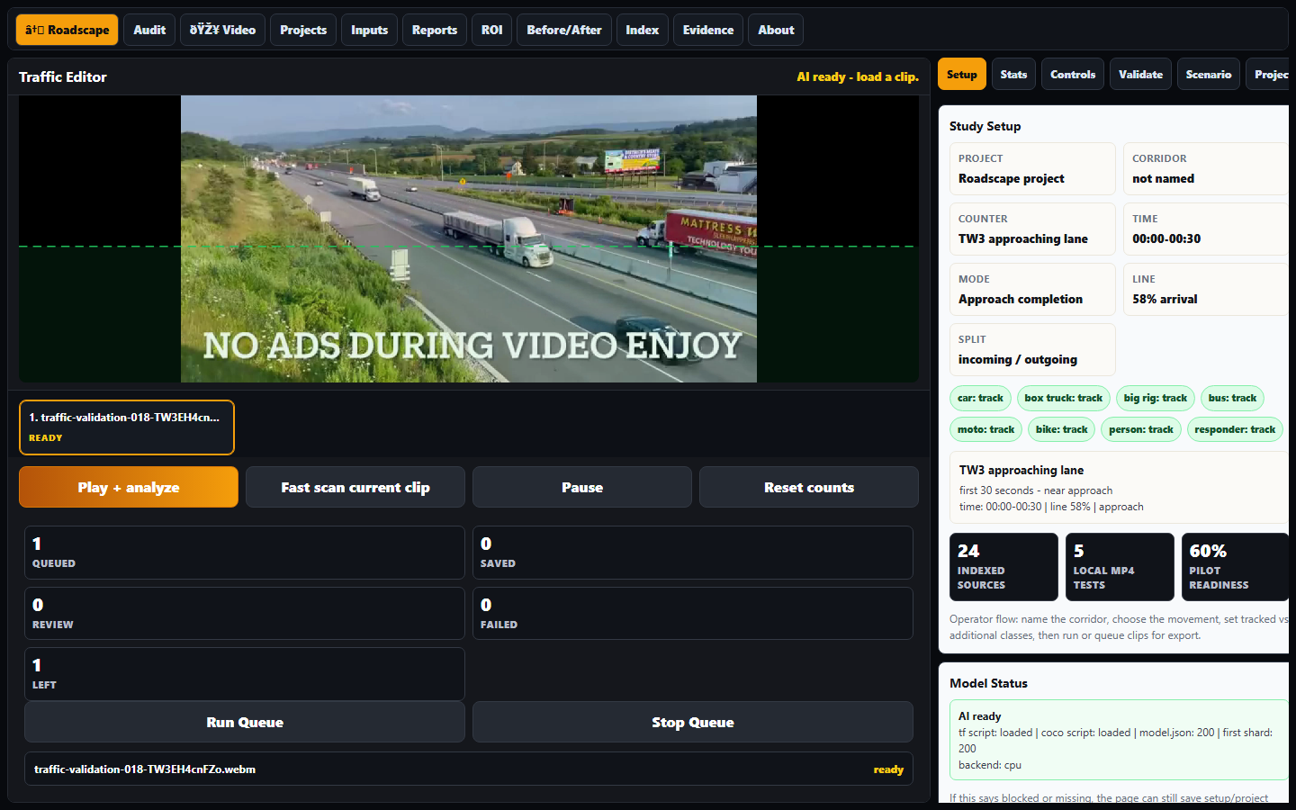
The product view now leads with the real Traffic Editor: load a real clip, define a named segment, run the scan, inspect counts, and export a report-ready packet. The old queue/setup mock shots are retired from the main proof view.
Real TW3 traffic clip loaded in the editor with the roadway frame visible and ready for segment setup.
Fast-scan view: visible count context, editor controls, and evidence that this is running as software.
Real test footage, Traffic Editor screenshots, segment exports, and the corridor-sim sweep are separated into their own validation page so the landing stays clean.
Roadscape prepares the evidence packet. Engineer-reviewed packets are routed through a third-party licensed civil/traffic engineer before being sold or represented as reviewed work.
See review tiersThe analyzer now loads the verified TW3 traffic clip as a WebM sample, with a segment workflow and report export smoke-tested from the actual UI.
Open analyzer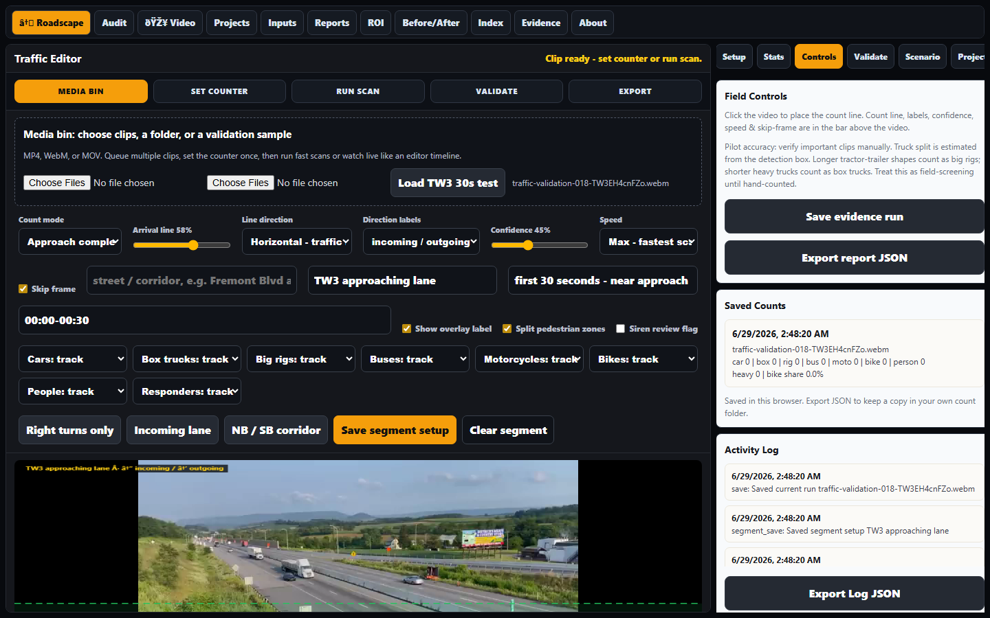
Public corridor preview: a treatment card showing evidence, backfire risk, and required measurements as a normal reference layer.
This is a short public sample, not city-related and not expanded internal analysis. It shows how Roadscape sorts one treatment by evidence, backfire risk, and required measurements before any official review.
Open corridor previewFood-for-thought figures that show why measurement matters. These are planning illustrations until a corridor study uses verified local counts.
If a corridor carries 25,000 vehicles/day and a redesign adds 20 seconds each, that is about 50 million seconds of driver time per year.
That same example equals roughly 13,900 hours/year. Roadscape separates raw counts from this kind of estimate so reviewers can challenge the math.
Credibility comes from hand-count validation by class when a reviewed packet needs it: cars, trucks, bikes, peds, responders, and turns.
The saleable output is one clean packet: scope, privacy, counts, charts, screenshots, caveats, engineer review lane, and recommendations.
Roadscape needs practical builders and licensed reviewers. They are not the same role, and that distinction is part of making the company credible.
A project manager from large builds can help with field process, jobsite reality, documentation discipline, scope, budgets, contractor language, and city-facing operations. This is a strong early teammate.
For official road-design conclusions, stamped recommendations, signal/geometry decisions, or pavement claims, Roadscape needs review by the properly licensed engineer for that jurisdiction.
Let the PM run execution and field protocol. Let the engineer validate assumptions, limits, calculations, and recommendations. Roadscape produces the evidence packet between them.
Code, geometry, and field evidence are the engine. Roadscape organizes the footage, measurements, assumptions, and export chain so a third-party licensed reviewer can evaluate it clearly.
Roadscape produces the analysis packet and evidence workflow. Any packet sold as engineer-reviewed or signed work goes through a third-party licensed civil/traffic engineer. Self-serve tool output remains self-serve analysis and operational evidence only.
Hand-count validation by class and movement: cars, trucks, buses, bikes, peds, responders, turns, queues, and missed detections.
Fixed rules for camera angle, clip length, weather, peak period, exclusions, sample windows, and before/after comparison.
Source metadata, screenshots, model version, settings, confidence, manual notes, assumptions, and export hashes.
Written authorization, clear retention, no face identity, no surprise surveillance, no audio storage by default.
Public and purchased data can layer in volumes, crashes, road geometry, permits, growth, freight routes, transit, and pavement context.
Roadscape models and screens. Licensed review handles official redesign, signal, geometry, pavement, and liability decisions.
Security docs, access control, data deletion, insurance, pilot scope, pricing, sample reports, and contract-ready language.
More clips are not just demos. They are training data, proof data, and business leverage. Every verified file makes Roadscape better at planning, measuring, and defending corridor decisions.
Process a copy, save JSON/screenshots/report outputs, verify the exports, and delete only the temporary working copy when cleanup is requested. Original footage stays untouched unless the owner explicitly chooses otherwise.
If a creator, camera owner, contractor, city, or property owner allows it in writing, Roadscape can process their footage under clear use terms. The point is not taking someone else's work. The point is building a permissioned platform where footage owners keep control and clients get better traffic intelligence.
Public now, no login. Runs in your browser on your own footage; nothing is uploaded. Load the TW3 test clip to see counts in ten seconds.
Local-first detection: cars, trucks, buses, bikes, people, line crossings with direction, evidence packet export.